A Roadmap to “Insurance + α”: Lessons from the Noto Peninsula Earthquake [Part 1]
- Sustainability
- Resilience
- Social Issues & Advancing Society
- Insurance & Risk Insights
A year has passed since the Noto Peninsula earthquake that struck on January 1, 2024. The disaster caused serious damage to the region, and the recovery process is still ongoing.
Looking back upon our response to the earthquake, members of Tokio Marine Group are considering how we can better support disaster-struck areas and improve disaster prevention measures. One way has been by increasing the amount of information we make available to the public, through services like “Road Condition and Ground Fissure Map” and “Screenshot Disaster Prevention.”
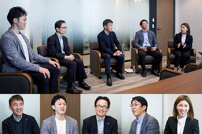
This article features Takehiko Enoki of the Kanazawa Branch, Nanao Sub-branch ; Kei Nishida and Tadashi Miyachi of the Claims Services Department; Ken Ito of the Personal Products Department Automobile Group of Tokio Marine & Nichido Fire Insurance (TMNF); and Makiko Kanda of the CX Promotion Department of E.design Insurance.
In Part 1, we look back on the Noto Peninsula Earthquake, what the situation was like on the ground, the challenges we faced, and the specific measures we took. Below you may find the link to Part 2, where we focus on the future and prospects for supporting disaster-struck areas.
Looking back at the challenges we faced
--- What was your experience of the Noto Peninsula Earthquake?
I am the General Manager of the Kanazawa Branch, Nanao sub-branch, which covers part of the Noto Peninsula. On January 1, 2024, I was on my way from Nanao City in Ishikawa Prefecture to my parents' home in Osaka. I rushed back to Nanao as soon as I heard about the earthquake. The extent of the damage I saw upon arriving was more severe than I could have imagined.
The roads were in very bad shape. There were cracks everywhere, mudslides, and boulders blocking the way, making driving extremely difficult. Lifelines such as water and electricity were almost completely severed. With utility poles down, traffic lights were not functioning. At night, the whole area was pitch black. To make matters worse, vehicles trying leave to leave the area were crossing paths with those heading in to provide relief, resulting in huge traffic jams. Police were unable to maintain control of the situation. It was total chaos.
I was particularly stuck by the gaps in the bridge girders, from half a meter to a meter high, making it impossible for cars to pass. Also, part of the expressway had collapsed, further limiting the access.
I had experienced quakes of seismic intensity of 6 or higher in the past. However, the Noto Peninsula Earthquake taught me first-hand that the damage at intensity 7 is on such a different scale, it’s hard to imagine.
--- What were the major challenges you faced immediately after the disaster?
One of the difficulties we faced in the wake of the earthquake was confirming the damage in person. As a non-life insurer, we need to confirm the status of damage on site when accidents or disasters occur. However, Okunoto region has always had poor access to transportation, and the earthquake made road conditions even worse. Many roads were closed, making it difficult to get to where we needed to be.
With the water supply severed and infrastructure severely damaged, we were also confronted with the problem of how to ensure the health and safety of our employees—for example our property loss appraisers—during on-site surveys.

In disaster areas, supply shortages are a massive problem. Immediately after a disaster, the national government and local authorities prioritize essential items, such as food, baby formula, and diapers.
But it takes a lot more than essentials to rebuild your life in the wake of a disaster. For example, when an earthquake-triggered tsunami or heavy rains cause flooding, water can seep under floors and cause mold. When that happens, people need circulators to dry out their tatami mats and the space below their floors, as well as sprayers to apply disinfectants. Public services alone can’t always cover these needs, which makes it essential to deliver these goods through donations and the good will of supporters from across the country.
Moreover, accurate information on road conditions is vital to quickly deliver these relief supplies. Understanding which roads are passable and which ones are blocked can greatly improve the speed and efficiency of relief efforts.
A framework to prevent information confusion
--- What is the Road Condition and Ground Fissure Map, and how did it help with the relief effort?
Immediately after an earthquake, it is difficult to obtain information about road conditions in affected areas. We wanted to reduce confusion on the ground as much as we could, so on February 2, about a month after the earthquake, we published the Road Condition and Ground Fissure Map.
We were able to implement this initiative thanks to the Drive Agent Personal (DAP) service introduced in 2017. The way it works is when a dashcam with communication functions installed in a customer's car detects a strong impact, it automatically connects them to an operator at the Accident Reception Center. The product transmits video captured at the moment of impact, enabling the operator to assess the situation and take swift and compassionate action, like for example calling an ambulance.
On the day of the earthquake, I received a call from the Accident Reception Center. They had received multiple reports of the DAP service detecting large tremors in Ishikawa Prefecture, which operators were able to confirm by reviewing dashcam recordings. After TMNF's disaster response command center was set up, we considered whether we could use DAP data to support disaster relief, and came up with the idea of developing a Road Condition and Ground Fissure Map.
One of the challenges posed by the Noto Peninsula Earthquake was extremely poor road conditions, particularly in the Okunoto area. By extracting and collating the impact detection and location information data from DAP customers who were in the area at the time, and laying that information over a map, we were able to triage road conditions in the Okunoto area north of Nanao City into three categories: 1) roads in good condition, 2) roads that are usable but in poor condition, and 3) roads that are completely impassable. Doing so gave us a detailed understanding of the road conditions in Okunoto. We then posted the Road Condition and Ground Fissure Map on the company's website, where it became a useful tool for disaster response and relief for many people. (Note: The map was taken offline at the end of March 2024.)
Data in the published map was an aggregated summary, and we obtained consent from customers regarding the purpose for which their data would be used. DAP was originally designed to respond to accidents, but our initiative showed how it could be used effectively for disaster relief.
--- Speaking of speedy responses, how did you make the Screenshot Disaster Prevention service available within 100 days of the earthquake?

Screenshot Disaster Prevention*1 provides disaster prevention information to car owners from three perspectives: disaster prevention, disaster, and evacuation.
For example, in the past E.design Insurance sent email alerts to individual customers in regions where snowfall was forecast, informing them of the increased risk of accidents and slipping on icy roads. We wanted to build out this service and inform people of emergencies when on the road, and do so as web content accessible to anyone. This led to the development of our Screenshot Disaster Prevention service.
Smartphones are key information tools to help people during an evacuation. However, disasters can lead to bad reception, or situations where users want to conserve their battery. That’s why we compiled disaster prevention information into a single image that can be downloaded onto your smartphone and viewed offline.
Japan is prone to all sorts of natural disasters, which can have devastating consequences. For example, data*2 shows that 70% of victims of the 2016 Kumamoto earthquake ended up sleeping in their cars. These are the kinds of circumstances we had in mind when compiling information that could be useful to people experiencing a disaster from their vehicle. From there we created content quickly, and were able to release our Screenshot Disaster Prevention service within 100 days of the earthquake.
Expanding possibilities through new value creation
--- Looking back on the initiatives you’ve been involved in, how do you feel about the role Tokio Marine Group has played in disseminating disaster-related information and creating new value beyond the boundaries of insurance?
By posting the Road Condition and Ground Fissure Map on our website, we helped not only our policyholders, but also other people in need, which felt very meaningful. I was reminded of how important it is during a disaster to assist victims by getting them accurate information quickly.
This initiative also helped me realize the potential value of insurers sharing data with the community. Moving forward, I want to expand our activities and explore approaches to communicate in a way that is easily understood by the rest of society.
At E.design Insurance, our mission is to co-create with our customers not only peace of mind in the event of an accident, but ultimately a world without accidents. In line with this philosophy, we focus not only on the payment of insurance claims, but also on preventing accidents and reducing the damage caused by disasters. The Screenshot Disaster Prevention service is a concrete example, helping customers achieve peace of mind by providing them with the information they need in an easy-to-understand manner in the event of a disaster.
Through these initiatives, we want to support not only our policyholders, but society as a whole. We will continue to actively promote the creation of new value beyond the traditional boundaries of insurance, and contribute even more to disseminating information about disasters.
Summary
In response to the Noto Peninsula earthquake, Tokio Marine Group has been disseminating information on disasters through services such as the Road Condition and Ground Fissure Map and its Screenshot Disaster Prevention. We believe that these initiatives are contributing to the creation of new value for insurance companies beyond the traditional payment of claims.
In Part 2, we highlight initiatives aimed at more rapid support for affected areas, including the use of satellite imagery and other digital technologies, as well as the creation of a platform to deliver the supplies victims need. We also delve into what the future of disaster relief and insurance looks like for Tokio Marine Group, collaborating and co-creating with a broad range of stakeholders and society as a whole.
-
*The information is current as of the time of the December 2024 interview.
-
*1"Screenshot Disaster Prevention" : A service created by E.design Insurance (Japanese Only)
-
*2Cabinet Office (Disaster Management), "Study Group on Implementing Support in Response to Changes in the Environment of Evacuation Life (4th Meeting)" (October 25, 2023): "Support for Evacuees Staying in Vehicles" (Japanese Only)