Predicting tomorrow’s flood today
- Resilience
- Social Issues & Advancing Society
Frontiers of flood hazard prediction – Toward enhancing flood disaster resilience -
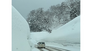
Water is an indispensable source of life. At the same time, torrential rains and floods claim thousands of lives and displace millions of people every year. They cause major disruptions across society, halting transportation, suspending business operations, and disrupting supply chains. As the climate changes, severe rainfall and flooding are becoming more frequent around the world.
The core challenge in flood risk management is how to accurately estimate potential future extreme floods. Rainfall records typically only go back about 150 years, so it is not easy to predict extremely rare hydrological events, such as once-every-200-year flood, with high accuracy.
Yasuto Tachikawa, Professor at the Graduate School of Engineering at Kyoto University, is seeking to develop better assessment tools. In a joint project with the Tokio Marine Research Institute, he is working to reduce uncertainty in future flood projections and enable more reliable risk assessment.
An analytical framework combining a predictive model with climate data archives
- Professor Tachikawa’s research team developed a framework for analyzing future changes in flood frequency and intensity using their proprietary rainfall–runoff model 1K-DHM and the climate projection database d4PDF.
-
1K-DHM (a distributed rainfall-runoff model developed by Kyoto University)
This model converts rainfall data into river discharge at an approximately 1-km spatial resolution based on conditions such as topography, land cover, soil composition, and geology, enabling the physically consistent reproduction and prediction of flood behavior.Basin topographic representation using digital elevation data and a distributed rainfall–runoff model.
-
d4PDF
A climate projection database developed by, among others, the Meteorological Research Institute of the Japan Meteorological Agency. By using the equivalent of several thousand years of climate simulations, it enables statistically more robust assessments of the frequency and magnitude of extreme precipitation.
This framework allows for a realistic assessment of risks, even for extremely rare, large-scale floods which previously involved substantial uncertainty.
What could happen in a world with 4°C warming
In this study, flood risks were evaluated for the basins of three Japanese rivers—the Arakawa, Shonai, and Yodo—each running through major metropolitan areas, under a scenario in which the global mean temperature increases by 4°C. The results indicate that the magnitude of a one-in-200-year flood could increase by approximately 1.5–1.7 times compared with the present climate.
Moreover, the peak discharge of what is currently a one-in-900-year flood—currently considered among the largest—was found to become nearly equal to the peak discharge of a one-in-200-year flood under the 4°C warming scenario. This suggests that flood control measures and infrastructure designed based on current projections may not be sufficient in the future.
When the analysis was expanded to 109 major river systems across Japan, an increase in flood risk was confirmed nationwide, with particularly large increases suggested for the Hokkaido and Tohoku regions.
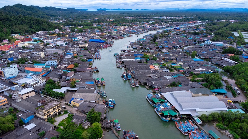
The framework was also applied outside Japan. In Thailand’s Chao Phraya River basin, the flood peak discharge was shown to increase by up to approximately 1.63 times, and the total flood inundation volume to more than double under the 4°C
warming scenario. Similar trends were observed in the Red River basin spanning Vietnam and China, highlighting that increasing flood risk is a global challenge.
Toward a flood prediction model applicable to data-scarce regions
One important outcome of this research is its aim to build a prediction platform applicable to a wide range of rivers worldwide, including small and medium-sized basins where historical data is insufficient. To achieve this, standard model parameter values were identified that consider factors such as land cover and geology, enabling predictions that reflect these land-surface characteristics.
The research team validated this approach across 15 basins and 104 gauging sites in the Kyushu region and confirmed that the model achieves a high level of predictive performance.
As a result, the study has evolved into an approach that can be applied not only to rivers in Japan but also to diverse rivers around the world.
Preparing for future floods
By improving the accuracy of river discharge predictions, this research can contribute to the design of flood control facilities, infrastructure investment planning, the development of hazard maps, Business Continuity Plans (BCP) for companies, and enhanced risk assessment in the insurance sector. It may also help improve forecasting, issue more accurate warnings, and improve evacuation during heavy rainfall and flood events. This framework is expected to serve as a foundation supporting a wide range of decision-making around managing the impact of flooding.
Tokio Marine Group actively supports research that helps address societal challenges. Enhancing society’s disaster resilience is a critical priority for our group, and we remain committed to supporting research that advances this goal.